
 |
| Add caption |


 |
| தொலைவில் இருந்து ஆயிரம் கோடிக்கணக்கில் பணம் செல்வு செய்து விவசாயிகளுக்கு செல்ல வேண்டிய நீரை மறுத்து உழவு தொழிலை பாழாக்கி விட்டு சென்னைக்கு குடிநீர்க்காக திட்டமிட்டு நீரை கொண்டுவர முடியும் என்றால்.. சிறிது திட்டமிட்டு..சில கோடிகள் செலவு செய்து.. மழை நீரை சென்னையை சுற்றியுள்ள ஏரிகளில் சீரமைத்து ஏன் சேமிக்க முடியாது..ஏன் மழை வெள்ளத்தை தடுக்க முடியாது..?dd caption |
 |
| Add caption |
 |
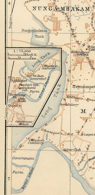
| Reshill Photograph of a well at Madras, taken by Frederick Fiebig in c.1851. The well shown in this view was one of a number of traditional forms of water supply and irrigation necessary in a dry region such as Tamil Nadu. Other forms included tanks and canals. A municipal water supply was later created for the city between 1868-1872. Water was piped from a reservoir called the Red Hills Lake, which was fed from another reservoir known as the Cholavaram tank, in its turn filled by a channel from the Korttalaiyar river. Little seems to be known about Frederick Fiebig. He was probably born in Germany and became a lithographer (and possibly was also a piano teacher) in Calcutta, publishing a number of prints in the 1840s. In the late 1840s Fiebig turned to photography using the calotype process, producing prints that were often hand-coloured. His photographs includes several hundred views of Calcutta in the early 1850s, one of the earliest detailed studies of a city, a large hand coloured collection of which were bought by the East India Company in 1856, their first major acquisition of photographs. Among the roughly 500 pictures were views of Calcutta, Madras, Sri Lanka, Mauritius and Cape Town.Add caption  மலைப்பட்டு ஏரி...அடையாறு உற்பத்தியாகும் இடம்....  இப்படியான ஆராய்ச்சிகள் எல்லாம் நிறைய செய்யப்படுகின்றன..ஆனால்..எந்த படிப்பினையும் இல்லை.. |